


Mount Aix is located in the William O. Douglas Wilderness, just outside Mount Rainier National Park. The pronunciation of this peak is questionable—I’ve read three variations: “Aches,” “Eye,” and “Ikes.” I’m partial to “Aches” (which translates to “pain”), as it makes sense given the amount of elevation gain you experience right from the start.


This account is a collection of information gathered by my adventure partner Sarah Johnson and me.
The drive from Portland is impressive, even with the haze from wildfires. I recommend stopping to stretch your legs at the Tipsoo Lake parking area, taking a walk around the lake, and admiring the nearby Naches and Yakima peaks before heading toward Chinook Pass on your way to Bumping River Road. Eugene, our climbing assistant and my driver, decided we should take a quick dip in Bumping Lake since we were camping and had the whole day to reach the trailhead.
 Trailhead location via GARMIN inReach MINI:
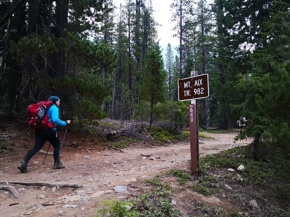
 We began our hike on Trail #982, which starts very gently (though briefly) before noticeably steepening. Bring plenty of water, as there are no reliable water sources to refill.


🛣️THE ROUTE:
We began our hike on Trail #982, which starts very gently (though briefly) before noticeably steepening. Bring plenty of water, as there are no reliable water sources to refill.
The trail is quite narrow in some sections, and there are parts—both in the forest and along the ridge—where a slip or fall could send you down a very steep slope.

The trail along the ridge and below the summit is narrow and traverses steep slopes. While the exposure is far from vertical, it is steep and open, which may make some hikers nervous, especially with all the loose rock on the path.
The real fun began on the final slope—an area where I felt both dizzy and excited. I was constantly searching for hand and footholds, as it felt like a vertical climb. By then, we had our helmets on and were very close to completing our mission.


Our views of Mount Rainier were obscured by smoke. The summit was swarming with flies—they didn't bite, but it seemed like a strange place for them to gather. We found remnants of nails, some glass, and wire. Amid smiles, joy at having reached the summit, and a good conversation with our Venezuelan climber friend (ANIBAL), we began our descent. I remember my knees trembling slightly, and I craved a beer before heading back to Portland. Unfortunately, the beer would have to wait more than 4 hours, and I could barely enjoy it before my eyes closed.
🏕️CAMPING
There are many camping spots around the trailhead, which is very convenient if you want to save time when ascending Mount Aix. There are even a few sites just before the tree line where you can set up an advanced camp if you want to push higher.

PARKING/ENTRY PASS. Northwest Forest Pass
-
A Northwest Forest Pass is required.
-
A Wilderness Permit is also required and is available at the trailhead.

 Mount Aix Summit – August 14, 2018
☀️CURRENT WEATHER
⛰️MY RECOMMENDATIONS
- Mountain Hardwear Direkt 2 Tent: Highly recommended—ultralight, easy to set up, and a perfect blend of quality and design.
- MSR Reactor Stove System: This windproof stove produces heat quickly and maintains constant pressure for optimal fuel regulation and consumption. It can boil 1 liter of water in about 3 minutes.
- Snow Peak Titanium Spork: A Japanese-designed super tool for outdoor cooking in three words: durable, lightweight, and versatile.
- Garmin inReach® Mini: An essential tool for remote areas—it allows you to send messages, post on social media, send SOS signals, track your location, and more, all in the palm of your hand.
- Alltrails: Recommended for digital maps—you can use them even without phone service.
If you want more details or recommendations, feel free to contact me.
I hope this brief information helps you plan your adventure to Mount Aix.

If you accept the challenge, this climb will be a memory you'll cherish for a long time.