


Mount Ellinor, in the southern Olympic Peninsula, is a popular peak with a short approach and a beautiful 360-degree panorama when the weather allows.

Located in the spectacular Olympic Mountains of Washington, Mount Ellinor is the southernmost high peak dominating Lake Cushman from the north.


🛣️THE ROUTE
As planned by our provisional lead guide Christine, I met the rest of the team at the lower trailhead at 7:45 a.m. to start our hike at 8:00 a.m. Christine gave us a short welcome message, and we began our ascent.
The first part of the trail is through a forest. We walked under cloudy skies, and as we progressed, we could feel the incline gradually increasing—but nothing impossible.
Since the group had mixed experience and fitness levels, we took periodic breaks.

The group was quite large (11 people including guides), which made the hike a bit slower than usual but very fun. The ascent was relaxing and beautiful, with incredible views.

During a short break, we saw the sign pointing toward the summit, but we still had a ways to go.

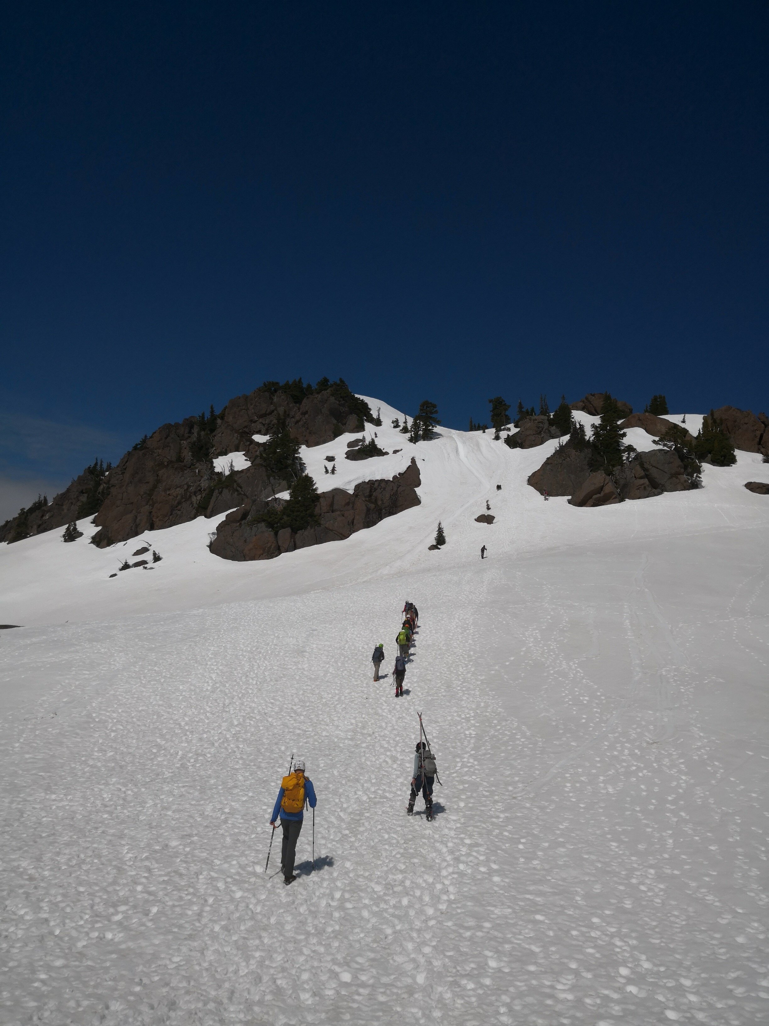
In this area, we stopped for a pleasant break (rehydrating, eating snacks, etc.) before starting our ascent on snow using crampons, an ice axe, and climbing helmets.
The route seemed long from the base of the ramp, but once we started climbing, we realized the slope wasn’t too steep.
The snow conditions were firm and a bit hard in some spots, so we used crampon techniques and ice axes. At one point, I stopped and anchored myself with my ice axe to take some photos.

First view of the south face ramp:

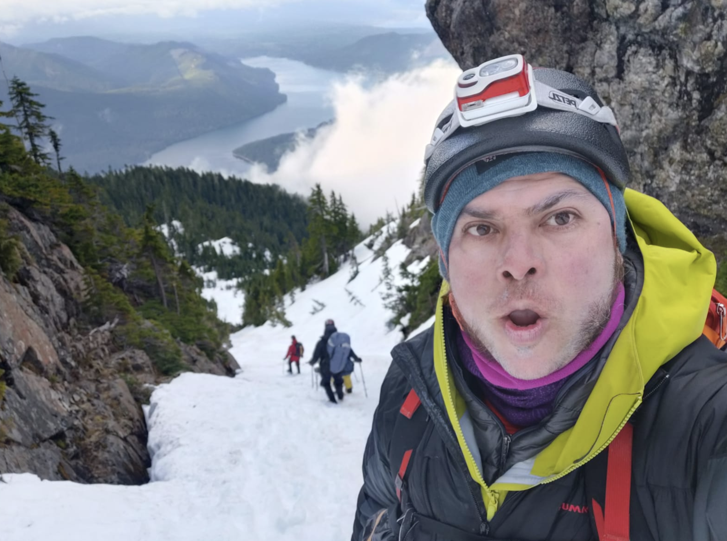
 “Milo,” lead guide from Mazamas:
After climbing a fairly steep slope, we thought we were very close to the summit:

But in reality, we had two more climbs to overcome before reaching the actual summit.
 Final steps before the summit:

False summit:

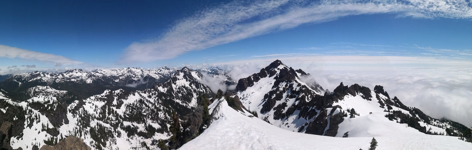
Panorama from the summit of Mt. Ellinor. May 23, 2021:

Mazama
Mazama (mountain goat), right next to our summit, making the experience memorable:


SUMMIT!!

Our guide “Christine Troy” checking the best route for glissading on our descent:

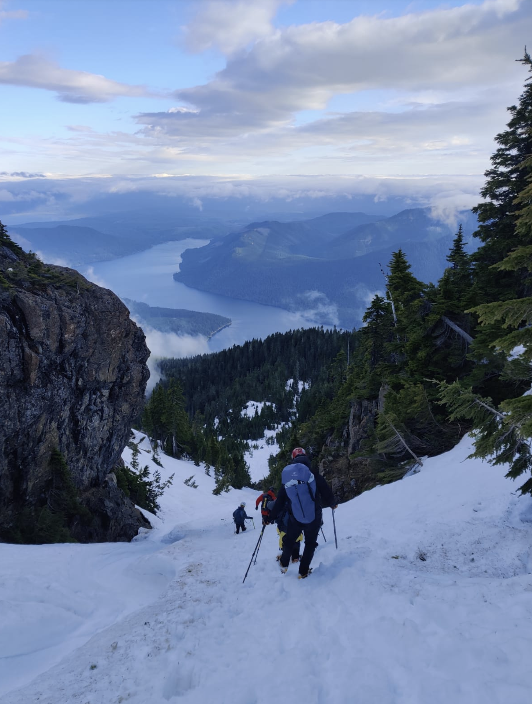
After summiting, we began descending to a valley just before a section with a huge rock. Following our guide’s suggestion, we descended using crampon techniques.
We reached a point where conditions were slightly better for glissading. After 2 or 3 people had successfully descended, it was “Sandra’s” turn. Unfortunately, during her descent, she suffered multiple unexpected spins that resulted in a fractured ankle (as seen in the video and photo below).
 Glissading in the accident area:

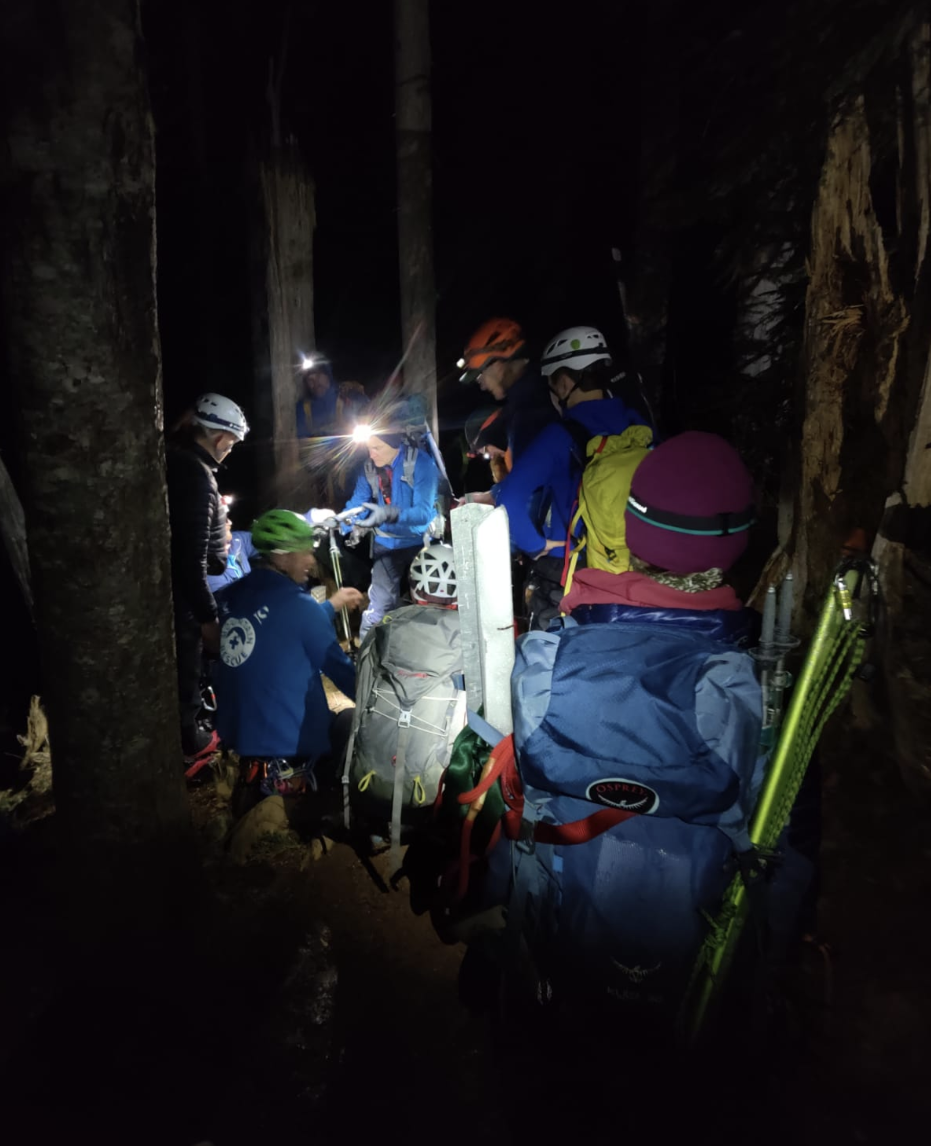
The hike to the summit took about 4 hours and extended to at least 12 hours due to the rescue, allowing us to bond as a team under extreme difficulties.
We returned to the parking lot around midnight, so Tom (my carmate) and I decided to drive back to Portland—a long but happy journey.
For me, in many ways, this was an epic trip—not only because we summited, but because we connected as a team. There were hours of cold, lack of food, stress, and concern for our teammate, but we overcame it all.
Without a doubt, an epic and unforgettable summit!

Staying calm, reassuring the team, thinking positively, and maintaining self-control are super important in these types of situations. The mind is our worst enemy in these cases and can lead us to make poor decisions.
🏕️CAMPING
We decided to go a day earlier and camp at Potlatch State Park, a relatively close park (about 35 minutes from the meeting point to start the hike the next day).

 Another option if you don’t want to camp is to leave very early from Portland. The drive is about 3 hours, so I don’t really recommend it.

PARKING/ENTRY PASS
LOWER TRAILHEAD: NO forest pass is required for parking at this point.
UPPER TRAILHEAD: A Northwest Forest Pass is required at the upper trailhead.
☀️CURRENT WEATHER
Mount Ellinor Weather Forecast
⛰️ MY RECOMMENDATIONS
- Start very early in the morning (7 a.m.). At that time, the snow is harder and allows for faster progress.
- Every climber should be trained and experienced in self-arrest, crampon techniques, first aid, and navigation.
- For those with skill and experience, consider doing this hike on a weekday and/or very early.
- To heat chocolate, we used my friend Tom’s Optimus Elektra FE stove—highly recommended for this type of camping.
- Crampons are more than necessary on this type of terrain. One of the best on the market is the Petzl Vasak.
- I recommend using the Alltrails for digital maps (you can use them even without phone service).