

![MOUNTAINEERING | MT. ADAMS (South Climb), Washington [2020]](http://locoporlaaventura.com/cdn/shop/articles/WhatsApp2BImage2B2020-07-092Bat2B4.42.492BPM2B28129_19258e2e-630a-4b5d-a6af-8dfe92611745.jpg?v=1757519180&width=1600)

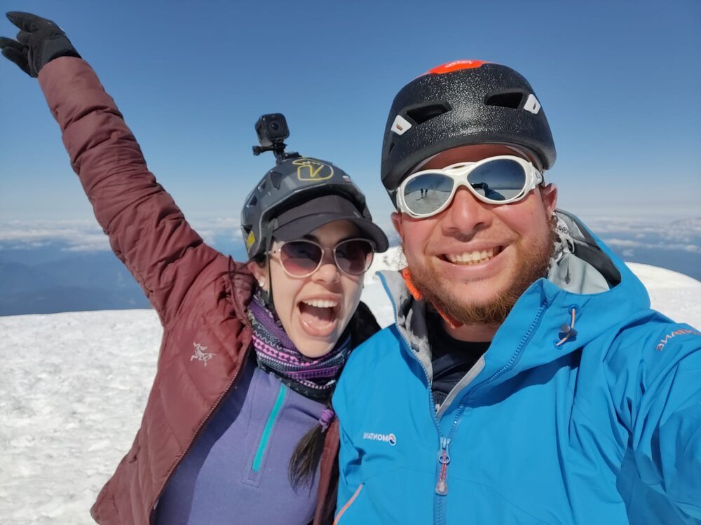
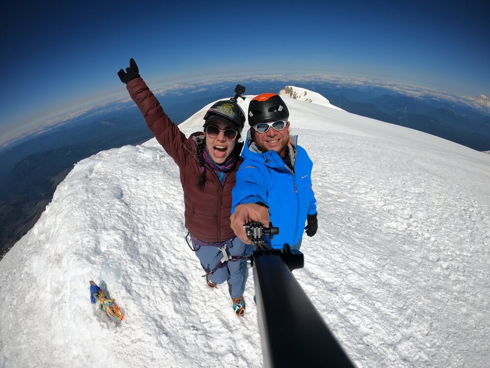 Mt. Adams Summit 10:13 A.M (July 5, 2020)
The South Side climb of Mt. Adams lets adventurers summit Washington's second-highest peak, a 12,276-foot giant rising from a remote wilderness.


Immersed just hours from the city one might feel like you've traveled thousands of hours to reach this mountain of nature and remote landscape.

Dogs are permitted on this trail, but they probably won't be able to reach the summit, so keep your pet's physical condition in mind before exposing them.

Mt Adams was called Pah-to, or Pahdo, "son of the great spirit," by Native Americans.
🛣️THE ROUTE:
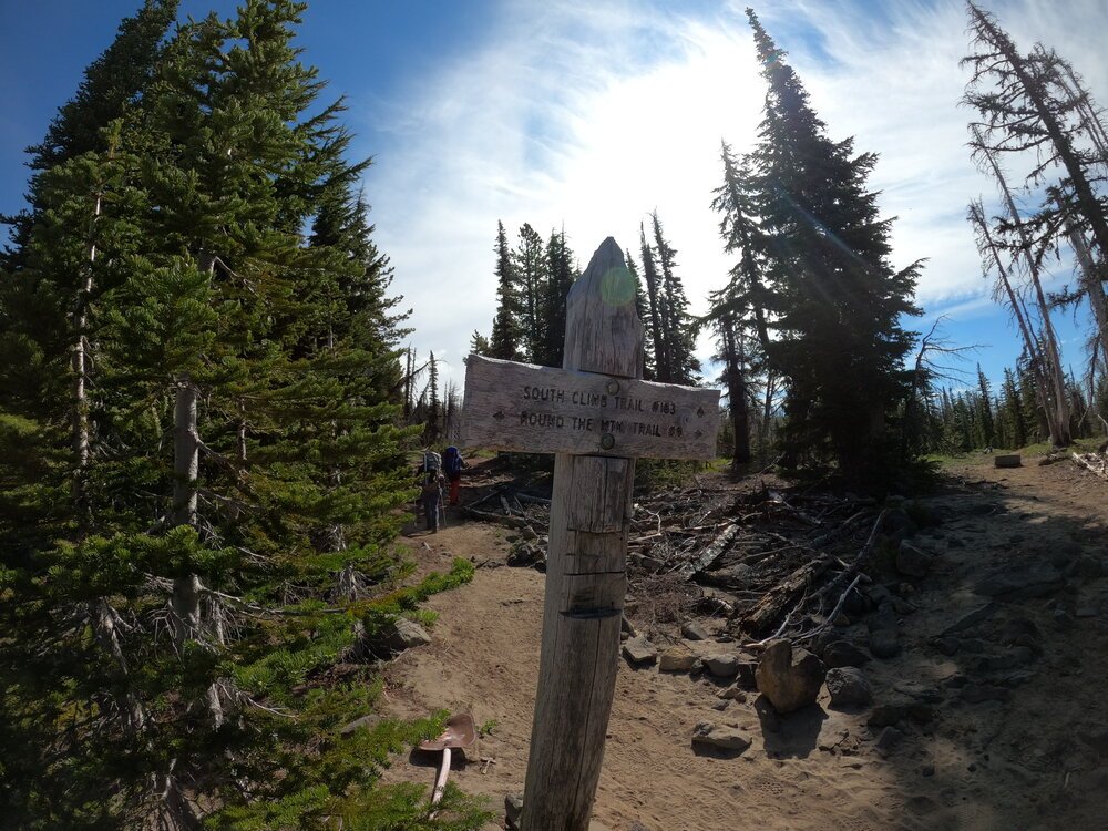
We began the hike on trail #183 South Climb through pine forests and some areas burned during a wildfire that occurred in 2012, then after approximately an hour we found the first portions of snow on the path. This climb can easily be done in 1 or 2 days with crampons and an ice axe.
During late spring and early summer (usually until July), you can also use this fairly vertical mountain for intermediate-level skiing/snowboarding.
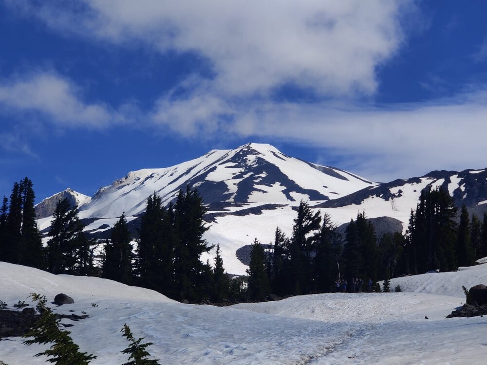
We advanced along the route until reaching our base camp at Cold Springs, at 5,600 feet elevation. We organized our camp, prepared food, melted water, and prepared for our summit attempt.

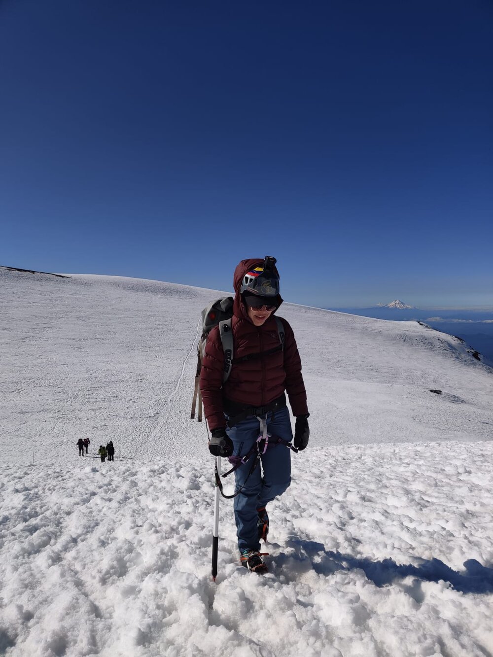
On the second expedition day, we began ascending at 4:30 am and at 9,350 feet elevation, toward the area called "Lunch Counter." There we took a well-deserved rest and continued our hike to what we thought was the summit, but it was simply a false summit or false peak called "Pikers Peak," located at 11,657 feet elevation.
But, finally, after ascending a few more meters, we managed to summit Mt. Adams, the first summit of this season for me and the first mountain my wife managed to do in the USA Yay!!!!
The glissading descent was epic, we slid approximately 2,000 vertical feet uninterrupted.
After descending, we disassembled camp and returned to my truck to go home. Would I do it again? OF COURSE!
It's considered a non-technical climb. This means that to climb the mountain, you won't need specialized equipment (although I particularly recommend using an ice axe and crampons), plus discretion and lots of common sense.
 Arriving at our base camp.
🏕️CAMPING
There are many places to camp around the base of the mountain called South Butte (7,750 feet). Although within the mountain, there are other camping areas, like Timberline Campground (6,267 feet), South Butte is the most convenient area, as it's closer to the summit, meaning fewer hours to walk the second day.
Generally they are moderately flat terrains with certain rock protections around to prevent strong winds from entering. However, don't forget to secure your tent well with rocks or some additional weight to prevent it from flying away in strong winds.


This is a real mountain. Despite being categorized as a non-technical mountain, there have been a number of injured and lost climbers on this route. Weather can change quickly like on any major peak, each climber must be prepared to spend the night in case of emergency or bad weather.
PARKING/ENTRY PASS
If you go up to 7,000 feet you require:
- Wilderness permit available at the trailhead. They are free and available at the Forest Service ranger station.
-
Northwest Forest Pass (Purchase at ranger station)
CLIMBING PASS (If you go above 7,000 feet you require):
- Wilderness permit available at the trailhead. They are free and available at the Forest Service ranger station.
- Climbing pass, from May 1 to September 30. The cost for three days during weekdays is $10 dollars and weekends $15 dollars. You must have it with you at all times and could leave a copy on your car window in case of emergency. BUY THE PASS HERE!!!!
☀️CURRENT WEATHER

If the day you summit, you're lucky enough to enjoy a clear sky, you can see Mt. Jefferson, Hood, St. Helens and Rainier.
⛰️MY RECOMMENDATIONS
- I advise leaving very early in the morning to climb when the harder snow still holds and allows us to advance more quickly. To descend you can use skis, snowboard or slide down the soft snow through chutes (glissading).
- Each climber should also be trained and have previously practiced self-arrest, crampon techniques, first aid and navigation.
- If you plan to start your route very early or simply want to have the best lighting in your camp, fully rechargeable, compact and with great light projection (900 lumens), you should definitely have Petzl SWIFT RL
- Mountain Hardwear Direkt 2 Tent, recommended, ultralight, easy to set up and combination of quality and design.
- MSR Reactor Stove System new technology creates a windproof kitchen that produces heat in a short time and maintains constant pressure for optimal regulation and fuel consumption. You can boil 1 liter of water in approximately 3 minutes.
- I recommend you use a climbing helmet on Mt. Adams, due to the danger of falling ice or rocks on the ascent. Your helmet must meet climbing certifications like the Petzl Sirocco Helmet.
- I recommend using the Alltrails for digital maps (you can even use them without phone signal).